ATLANTIC-ARCTIC AGORA

- Title:
-
ATLANTIC-ARCTIC AGORA
- Start Date:
-
01/12/2022
- End Date:
-
31/05/2026
- Funding Body:
-
European Union’s Horizon Europe
- Coordinator:
-
UNIVERSIDADE DE AVEIRO, PT
- Project Partners:
-
Cork County Council (CCC)
- Principal Investigators:
- Research Area:
- Website:
Introduction
The A-A Agora Project
The Horizon Europe funded project Atlantic-Arctic Agora’s full title is “Blueprint For Atlantic-Arctic Agora On Cross-Sectoral Cooperation For Restoration Of Marine And Coastal Ecosystems And Increased Climate Resilience Through Transformative Innovation”
A-A Agora is structured to support the ambitious targets set in the European Commission Mission to “Restore our Ocean and Waters by 2030” and, in this way, to meet the requirements on innovative and transformative change enabling the “Atlantic- Arctic Lighthouse”. The project aims to:
- Protect and restore marine and freshwater ecosystems and biodiversity, prevent and eliminate pollution of our ocean, seas and waters, and make the sustainable blue economy carbon-neutral and circular.
- Protect valuable ecosystems located in coastal communities particularly vulnerable to climate change impacts, namely the risks of sea level rise and the loss of biodiversity due to increased pollution.
- Mitigate the effects of climate change by increasing engagement and promoting societal well-being.
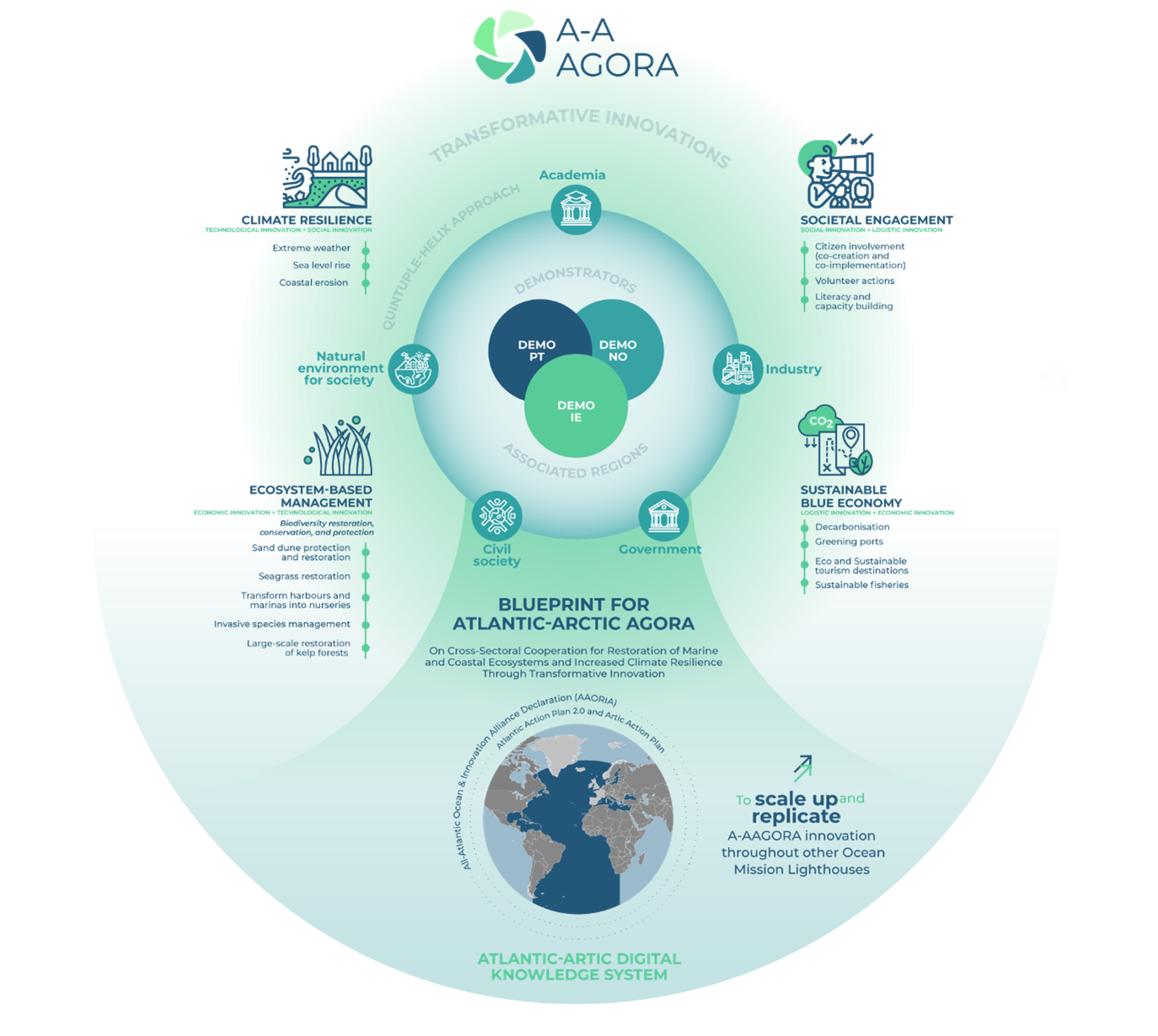
There are three demonstration areas within this project, one in each of Portugal, Norway and Ireland. More information on the A-A Agora project can be found on the project website
The Irish Demonstration Area
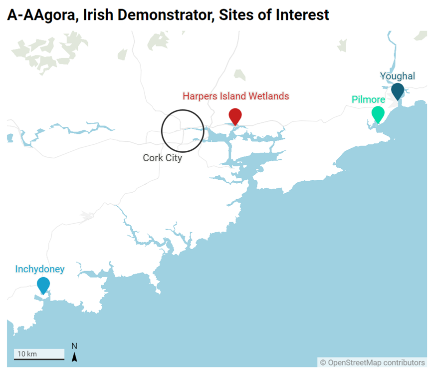
The Irish Demonstration Area aims to explore the interplay between coastal protection, climate adaptation, and nature-based restoration, taking advantage of an engaged citizenry to promote an integrated and participatory approach to coastal management and planning. The initiative seeks to improve the knowledge base to support informed decision-making and facilitate partnerships at the local and regional levels. This work will be achieved through joint working and collaboration between MaREI and Cork County Council. The figure below illustrates the activities within our Irish Demonstration Area
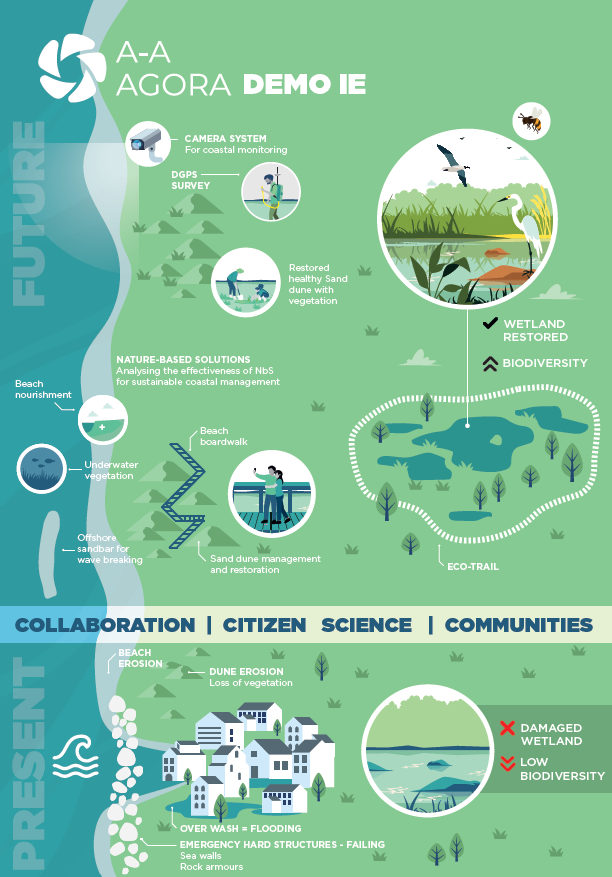
Harpers Island Living Lab
Harper’s Island is a small low-lying island near Glounthaune in the northern section of Cork Harbour, Ireland. Further information about the area can be found at the Harper’s Island Website
The A-A Agora project has compiled a case-study of this site through conducting semi-structured interviews with members of the Harper’s Island Wetlands steering committee, BWI members and Cork County Council staff and elected members. The output of these interviews was developed into a reflective brief, outlining the journey taken by the community, including recommendations and lessons learned, which can be used by other groups and communities interested in undertaking a similar exercise. The case study design and approach was co-created with the steering committee at Harper’s Island and can be downloaded here
This case study highlights key processes, partners, skills and contributions which made this a very successful community-based nature restoration project.
Coastal Challenges and Monitoring
Camera at Inchydoney
Inchydoney is a key site for coastal protection in West Cork. The beach and sand dunes are subject to highly energetic winter waves, currents, and wind, shaping and changing their morphologies. Within the A-AAgora project, the research conducted by UCC and supported by CCC consists of deploying a coastal monitoring camera at a key location at Inchydoney Beach to gather scientific knowledge and help decision-making and sustainable management.
The purpose of the camera is to look at sediment transport and morphological changes of the beach/dune system to assist future decision-making. The camera is overlooking the whole coastal system in Inchydoney, and the camera angle is broad enough to cover a maximum of beach/dune surface. Crucially, the pixel resolution of this camera is not high enough to recognise faces or small features. The camera is not recording continuous footage – it is simply taking one photograph at intervals of approximately 30 minutes during daylight hours. This frequency may be increased in the case of storms or other weather events that would affect the dune system.
More information about the camera and its characteristics can be found here.
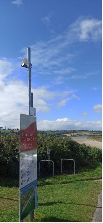
Coastal Monitoring Camera set up at Inchydoney. The camera can be seen towards the top of the pole in this photgraph
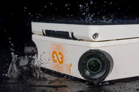
The Coastal Monitoring Camera used at Inchydoney
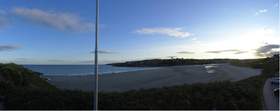
An example of the view of the coastal dune system at Inchydoney from the monitoring camera at Inchydoney. This photograph was taken on 12th September 2024.
In time, this detailed research will support broader research goals focussing on coastal changes and understanding coastal processes in a context of climate change across Co. Cork and indeed in Ireland.
DGPS surveys at East and West Cork
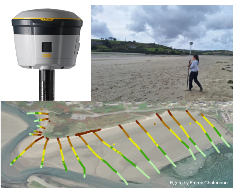
Topographic surveys are methods commonly used to look at the beach/dune system shape and morphological evolution. Surveys are conducted using a Differential Global Positioning Systems (DGPS), which records the position of the operator in 3 dimensions (longitude, latitude, elevation).
Our study aims to better understand short- to long-term coastal processes including sediment transport and exchanges within the dune/beach system and with the ocean at east (Pilmore/Youghal) and west Cork (Inchydoney). Surveys consist of a series of cross-shore profiles done at low tide, to cover a maximum of beach surface, walking. The data are then processed and used to analyse changes in link with waves, storms and seasons.
Maptionnaire
The A-AAgora project aims to cooperate with citizens, stakeholders and communities to better understand challenges at the coast. In this context, we created a Mapitonnaire called “Erosion… our coasts at risk” in association with the company Mapita Oy. A Maptionnaire is a questionnaire that uses mapping, with the purpose of collecting information from citizens with an informative component. Our Mationnaire focussed on erosion issues in Inchydoney and Youghal and coastal management.
If you’d like to participate in the survey and help us collect data about erosion in Co. Cork, please click on the following LINK
Work Packages
Through 7 complementary Work Packages, the A-AAGORA consortium will deliver the project, supporting the ambitious targets set in the European Commission Mission on “restore our ocean and waters by 2030” through the reduction of pressures in coastal areas to boost resilience to climate change and mitigate its impacts.
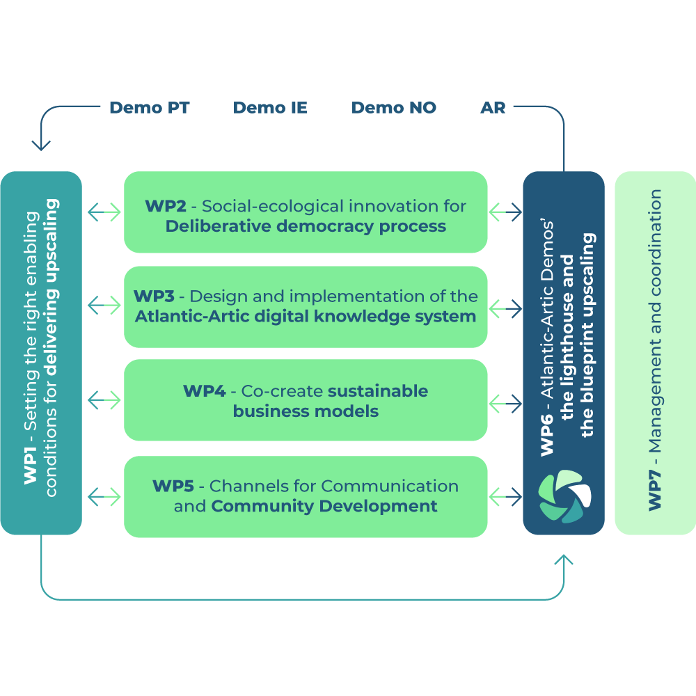 Further detail can be found in the A-A Agora project website

